Landcover Classification
Challenge
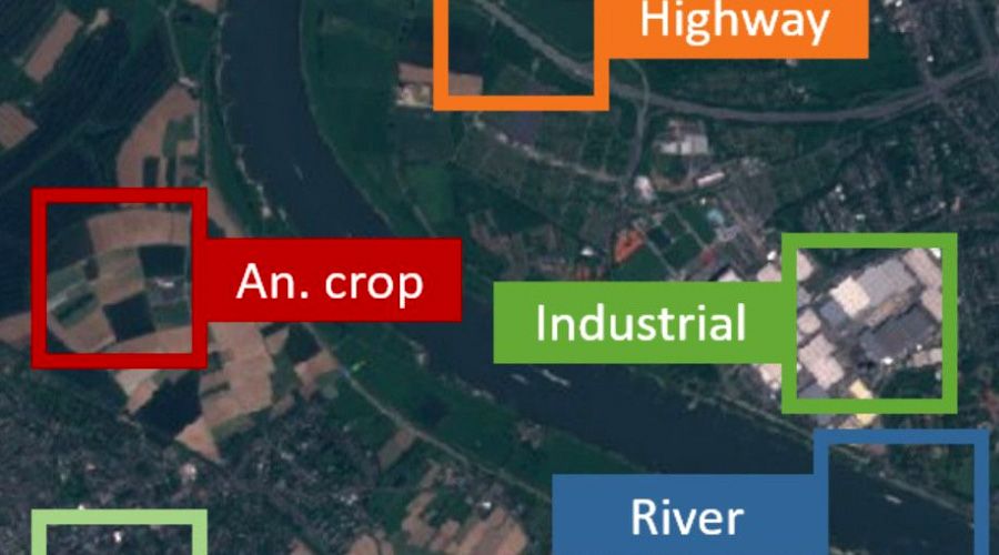
Traditional maps only share part of the bigger picture; they miss classifications about what makes up the land, such as water, types of forests, snow, grasslands, etc. Interplay® is used as a land classification system to clearly define land class boundaries. This can then be graphically mapped out and scaled to any geographic location.
Solution
Landcover classifications can be used to understand the environment, including habitat availability, climate change contributors, pollution and chemicals, frequency of natural and urban settings, and general monitoring of the ecosystem. Accurate land cover classification is vital to understand how to use a specific environment.
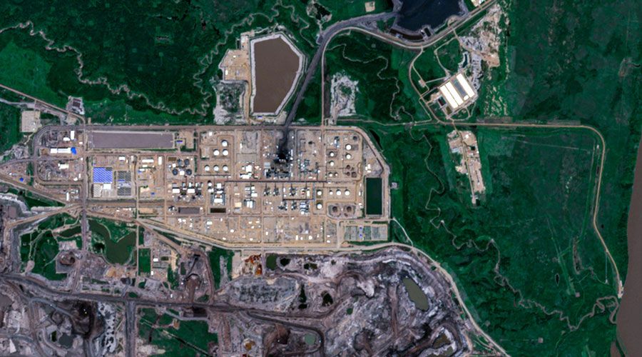
Interplay can take an inbound stream of images (satellite or aerial photos) and then classify the land types according to any trained data set. Because this leverages AI, landcover analysis can be done at huge volumes and repeatedly-- showing the change in landcover (i.e., as forests are cleared, flood damage occurs, or industrial areas are built out). These tools are valuable to the Intelligence Community and non-profit environmental organizations.
Deployment
Data security is paramount for Interplay within run-time production environments. As needed, Interplay can function as a stand-alone server within SCIF (Sensitive Compartmented Information Facilities) or other sensitive facilities.